Following the Mardyke Way
- Parks and Pavements

- Jun 5, 2018
- 4 min read
Updated: Dec 4, 2018

Prior to the school holiday I'd taken a look at new places that I could visit over the coming months. One idea was to head east and run the length of the Mardyke Way. In the past I've cycled the route but have never explored it on foot, and never ventured off of the main route to discover the spaces that surround it. But today I got the perfect opportunity to do both.
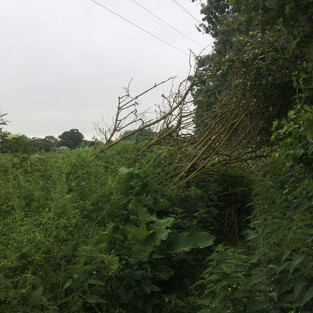
Parking up in an nearby road I crossed the A1306 and began my journey by heading down a small public footpath which cut across the local fields to the start of the Mardyke Way. It soon became clear that this was a bad decision as the path quickly turned into a trek through the Amazon jungle. With shoulder-high nettles surrounding me on all sides I trudged along a loosely trodden path for half a mile at a snail's pace, enduring sting after sting to my legs. In retrospect it would have been far easier to skip this path altogether and simply stick to the main road (which I did on my return) but I guess this is what happens when you try a footpath for the first time. That said, this must surely rank as one of the most neglected examples I've ever come across - poor show Thurrock Council.

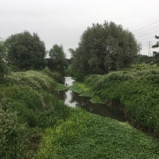
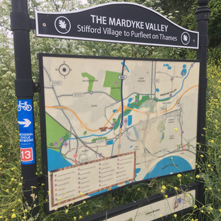
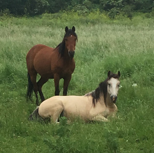
The path ran alongside the Mardyke river and finally emerged at a road bridge on Ship Lane. Crossing over you could see that the bridge had recently been restored with new stone pillars, and the view down the river from here was really quite pleasant. It was here that I noticed the official Mardyke Way route sign and map to my left, and from here the path was wide and flat with a compact gravel surface that made it ideal for running. During winter much of the land by the river can get flooded, so it was good to see that the sunny weather we've had lately ensured that today's journey would be a dry one. The route follows the course of the river closely - winding this way and that - past ponds, marshes and green fields. There was plenty of wildlife to spot in this semi-rural retreat too. Herons, ducks, horses and rabbits were all seen, and I'm sure that there are more creatures hidden away from view for those with more patience. As I passed under the mighty concrete supports that hold up the M25 I felt a strange sense of solitude. So many hundreds of people zooming past above my head, yet down here there wasn't a single soul; just nature for company. The weather was cloudy and warm, and the air still and quiet.
After a mile or so, I reached a fork in the path. There was signage for Mardyke Woods and a dirt track heading off into the trees to my left, which I decided to take for a change of scenery and the tempting opportunity for some cooling shade. Although quite a small plot of land, this woodland is one of the oldest natural forests in Essex and dates back to Roman times. There are several children's play areas and nature trail to follow if you want but on this occasion I gave them a miss. As I ran along the undulating path under a fantastic leafy canopy I passed a couple of dog walkers, but soon I was alone again. Shortly after the forest itself also came to an end, and I re-emerged onto the Mardyke Way to continue along my original gravelly route.

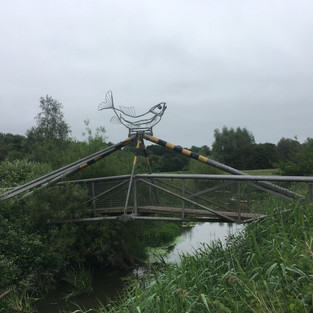
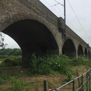
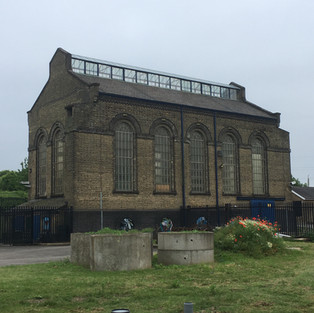
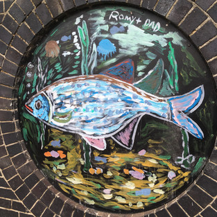
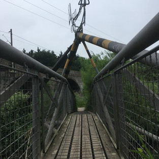
A few minutes later I reached another junction with a bridge to my right, leading to the Davy Down Riverside Park. As I was aware of he time I'd been out, and the fact that I'd have to re-trace my steps to get back to the car, I decided to complete a quick loop of the park perimeter and return to the same spot before heading back the way I'd come. The bridge spanned the river, and featured a metal sculpted fish at the top (apparently made from dumped metal found in the local environment). I crossed over and ran alongside an imposing Victorian viaduct (known locally as the 'Fourteen Arches') which now carries trains between London and Essex. The path was well marked with wooden borders, and led me through light woodland and in a loop past the car park to an elegant brick pumping station. I believe that this is (or was) a visitor centre or cafe, but at the time of my visit all the shutters were firmly down and there was no chance of a drink or snack this time round. After stopping to take a few snaps of the buildings and the great murals which adorned its walls I headed across the park's small nature pond and back to the fishy bridge.
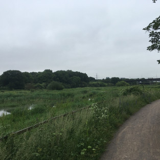
Back in familiar territory, I made a left turn and ran back along the Mardyke Way. For the next 30 minutes I passed wetlands with ducks and lots of bright white herons as I headed back to Ship Lane and on to my parked car - racking up a total distance of 5.1 miles. I think that I'll return here in future, and hopefully head on past Davy Down to explore the path towards Stifford Village. Watch this space!

The online map of the route can be viewed here.


Comments